


Flooding is dominant in shaping the biological, chemical and physical processes of the Amazon basin: an area of 350,000 km2 is flooded at high water (Junk et al. 1989), representing 20% of the Earth's fresh water (this is around 68 times the size of Trinidad & Tobago). The Amazon has great biodiversity (2.5 million insect species, for example) and absorbs 500 million tonnes of carbon per year (compared to 13 billion emitted by human activity) - it is one of the most important ecosystems on the planet.
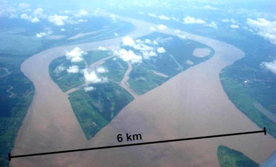
The Amazon has a Tropical climate with wet and dry seasons. Given the size of the basin, this results in a large annual floodwave with several metres amplitude. The typical amplitude at Manacapuru is around 10 m, giving a peak flow rate of about 120,000 m3s-1 (or 120,000,000 litres per second) - compare this to a large flood event on the Mississippi (around 30,000 m3s-1). Yet this location is still around 1,500 km from the sea, and the river doubles in size before it gets there. The shear volume of water passing down the river means that the flood process dominates everything close to the river. In 2012, the river reached the highest flood stage ever recorded.
Research in this project is developing a detailed hydrodynamic model of surface water flows for the várzea floodplain on the lower Solimões River, for a ~70 km reach downstream of the Rio Purus at a spatial resolution of ~90 m. As part of this, a detailed field campaign was carried out during the mid-rising and high water periods, during which floodplain bathymetry, volumetric discharge measurements and water samples were taken.
The overall aim of this research is to quantify and simulate the detailed dynamics of Amazonian floodplain inundation using a fine spatial resolution two-dimensional hydrodynamic model in order to better understand the hydrological functioning of such systems. In turn, this dynamic model may be coupled to models for carbon dioxide (CO2) and methane (CH4) emissions from flooded wetlands, potentially allowing more highly constrained estimates of flux rates, taking into account detailed hydrodynamics.
The University of the West Indies
St. Augustine, Trinidad and Tobago
Tel: (868) 662-2002
Fax: (868) 663-9684
Department of Geography
Faculty of Food and Agriculture
UWI St. Augustine
Tel: (868) 662-2002 Ext. 84129