|
March 2010

Issue Home >>
|
NEW PROGRAMME :Geomatics Engineering and Land Management
 The Department of Surveying and Land Information of The UWI has changed its name to the Department of Geomatics Engineering and Land Management. The Department of Surveying and Land Information of The UWI has changed its name to the Department of Geomatics Engineering and Land Management.
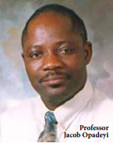
“In the last 12 years, our Department really has outgrown its previous name,” said Professor Jacob Opadeyi, the Department’s Head.
The Department now offers programmes in Land Management and Geomatics Engineering, an emerging field of studies which includes a range of disciplines such as land surveying, geodesy, photogrammetry, remote sensing, cartography, land and geographic information systems, urban planning, cadastral systems, global navigation systems and hydrography. Undergraduate offerings include Bachelor of Science (BSc) degrees in Land Management or Bachelor of Science (BSc) degrees Geomatics. For postgraduate students, the Department now offers Master of Science (MSc) degrees in either Geoinformatics or Urban and Regional Planning. Two research programmes were recently introduced: the Master of Philosophy (M.Phil) and Doctor of Philosophy (Ph.D) in either Geoinformatics or Urban and Regional Planning.
Geomatics Engineering is a modern, rapidly developing field of study which integrates the acquisition, modeling, analysis and management of spatially referenced data. Geomatics engineers use their knowledge of science, engineering and measurement technology to solve complex world problems. Technologies developed within the discipline have revolutionised global navigation, resource and environmental management and urban planning.
Career opportunities for the Geomatics Engineer span over both the private and public sector markets and range from the technical engineering fields to policy making and planning. The Geomatics Engineer will be able to work in any of these sub-disciplines and many related fields in the built environment.
Land Management refers to disciplines involved in the process of managing land as a natural resource in a sustainable way. It includes the sub-discipline of Land Administration, which involves determining, recording and disseminating information about the ownership, value and use of land. It also includes urban and regional planning, which involves the organisation and regulation of physical development in both the urban and rural landscapes locally and regionally, as well as valuation surveying, which is the process of developing a fiscal value for real property. The Department offers a specialisation of property valuation at the undergraduate level as well as graduate programmes in land administration and physical planning.
Graduates of the land management programmes have several opportunities for employment in both the private and public sectors as they relate to physical planning, property valuation, fiscal cadastre development, as well as managerial responsibilities in local government agencies.
For more information, please visit http://sta.uwi.edu/eng/surveying/BScInGeomatics.asp, or contact Professor Jacob Opadeyi, Head of the Department of Geomatics Engineering and Land Management at jacob.opadeyi@sta.uwi.edu or (868) 662 2002 ext. 2108 or 3313.
|


 The Department of Surveying and Land Information of The UWI has changed its name to the Department of Geomatics Engineering and Land Management.